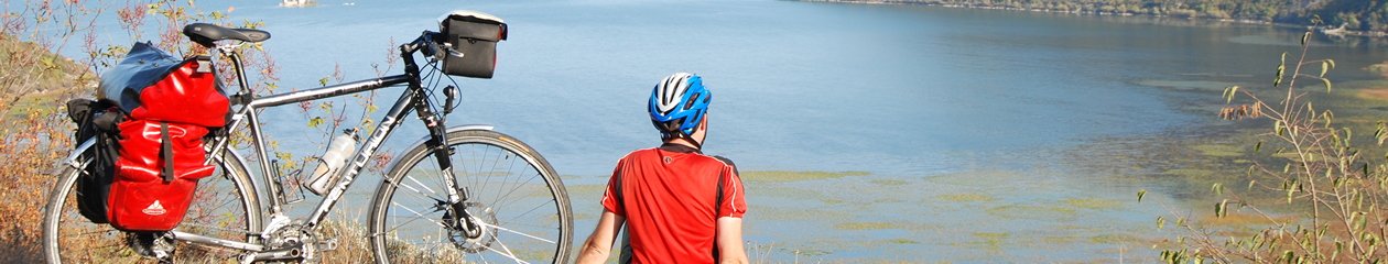

National park BiogradskaGora, once an ordinary excursion and picnic site centered around Biogradsko Lake, eventually grew into a real outdoor center that offers a variety of opportunities for recreation in the entire territory of this beautiful and unique national good. Along with accommodation possibility in bungalows, camps, mountain lodges and eco summer pastures, visitors have variety of opportunities for hiking and biking, fly-fishing, as well as horse riding.
Bjelasica, with its slopes and peaks that are relatively easily accessible is a real treat for fans of mountain biking. It is not surprising that several trails pass over the Bjelasica and through the zone of the national park, and among them there are two trails that belong to national Top trails network: TT3 – Enchanting East and TT2 – Discoveries in the north. Cycling offer constantly improves and local trails are being added, so that there are already several marked trails that depart from Kolasin, Bijelo Polje and Andrijevica, a National Park management plan for this year is the construction of two new tracks – one cross-country and one singletrack, the first trail of this type on Bjelasica mountain, which requires from the bikers not only good fitness but also technical knowledge.
What to choose and where to go if you have only one day available for cycling and exploring the national park Biogradska Gora and you want to see the best that Bjelasica offers and go home with as many beautiful impressions? That would definitely be hike-a-bike type of route which would encompass one of the last three primeval forests in Europe, the two most famous peaks of Bjelasica and most important glacial lakes hidden in cirques, surrounded by woods and pastures which will enchant you with their beauty. Along with the beauties of natire that you will be able to see, there are also indigenous structures of ethnic architecture and interesting local people. When you add to this mix a visit to Vranjak, beautiful and carefully designed traditional eco Katun of Darko Bulatovic, where you can take a break and taste local cuisine, then even before the start of the route it is clear that a fantastic, 62 km long adventure awaits those cyclists who choose to experience the most demanding and the most attractive moments offered by the National Park Biogradska Gora.
Two peaks and five lakes route
You should start this adventure early in the morning. And choose a nice summer day. A long and arduous journey awaits the tires of our two-wheeler friend while together we cruise through the heights.
We start from the Biogradsko Lake (0 km, 1120m) with a dirt road through the forest, through the ancient trees, overcoming a strong incline (10-12%). And it is good that it is so, because in this place you do not want to fly but breathe deeply as is only possible in mountain biking. Our aim is to overcome the numerous bends that will take us to Dolovi Lalevica (6km, 1680m) and from there to the first resting place and a must on your route – to the gazebo Bendovac (8km, 1735m). This is where you will get the best view ofBiogradska Gora and Biogradsko lake and it is worth making a detour on the seventh kilometer (pay attention to the signs) and ride these two kilometers in both directions because without Bendovac and the story you can see from this place, our adventure would lack a perfect panorama of the entire Biogradska landscape – permanently etched into this cycling memory.
From the crossroads where we had turned towards the lookout we continue with now easier climb and soon we will arrive at the Svatovsko groblje (13km, 1920m) and of Bjelasica ridge. While on the ridge the vistas open in all directions and riding is already lighter and totally relaxing. A much faster pace takes us over Jusin brijeg (14km, 1920m) and the Savine bare (16.5km, 1835m) to the source of the Biogradska river (Jaževi, 17km, 1810m), where it is well worth stopping for a bit, and then continue through Jagančarske rupe (18km, 1840m), below Zekova glava and Troglava, the mountain road that constantly keeps us faced towards Komovi takes us to a well-deserved rest in Vranjak katun (22km, 1750m). And here we should get a good rest and restore energy as another, much more demanding part of the adventure is ahead of us, and the next break can be taken at the mountain lodge Suvodo, on the exact opposite side of Bjelasica.
We say goodbye to Vranjak katun and head back along the gravel road we took when we came, and then on the second kilometer we turn right and continue our ascent toward Zekova glava. As we climb the ridge, on the right side we see Mican pastures, Govedji do and Bare, and on our left the slope to the top of Troglava. 5.5km from Vranjak (27.5km from the start) finally we are at the top of the first peak, just below Zekova head (2117m), at over 2000 meters above sea level, and this point is also the end of the first gravel road stage of this trip. It is actually a moment where we enter the hike-a-bike section 5.5km long, which is not so extreme and much of it can be passed riding a bike, and in particular this applies to those who are accustomed to riding the bike at such terrains.
On the hiking trails
On the east side of the repeater, facing northeast, our key landmark is the highest peak of Bjelasica – Crna glava (2137m). That is where we are heading to. On the same side, all the way underneath us, in one of the largest cirques of Bjelasica, we can see maybe the most beautiful glacial lake in Biogradska Gora – Pesica Lake (1840m). Surrounded by high peaks and cliffs, beech and pine forests and pastures, anyone who has ever gone here left breathless. The lake is 290 meters long, and the maximum width is about 165m. The average depth of the lake is about 3 m, and the maximum depth is about 8m. It is the second largest lake in the region of National Park Biogradska gora, and there is a legend linked to it, according to which a winged, white horse would come out of th lake at nights, that the forest fairies from the surrounding area admired.
After a few hundred meters of the strong rise along the steep meadow, the hiking trail takes us to Galica (31km, 2065m), the location that extends all the way up towards Vrna glava peak, and is interesting not only because it gives you a perfect view of Ursulovacko lake, but also for the fact that everywhere around you can see special pine tree called Krivulj. For a little while we will push or carry our bikes, and we are already below the peak Crna glava, and only 150m more to reach it. Who hasn’t been here before now has a chance to conquer the highest peak of Bjelasica. At this point we connect to the trail that is one kilometer long and takes us to the banks of the lake Ursulovačko (32.5km, 1904m).
From Ursulovac we head exactly towards the east, descending slope below the peak Cmiljača (1962m) to a smaller katun (Scekici) and immediately afterwards, through pine tree grove, here we are again on the gravel road (34km, 1730m), which will take us through the dense forest and shade very quickly down to the mountain lodge Suvodo (40km, 1300m), which is another good opportunity for a longer stay. In addition to traditional dishes here you can find trout, and if it is the season of watermelons, you will find it well chilled in spring water.
We are entering the last stage of this trip, and riding through the katun Suvodo (42km, 1475m) we reach the Sisk katun and the last two glacial lakes on this tour – Šiško (45km, 1665m) and Ševarinsko lake (46km, 1650m).
This is a very nice area, and after several hours of total wilderness now it feels good to ride through the flocks of sheep, say hello to the shepherds, and even the dogs do not bother us while they are angrily rushing behind us. Although many people will not count Sisko lake among the most attractive glacier lakes in Montenegro, it certainly has its charms. This place would not be the same without this lake sleeping quietly under Zuber (1848m). And only when you get on top of Zuber, you see how much this lake enriched these pastures. And because of it everyone likes Siska katun.
Large Sisko lake is 195m long, 130m wide has a maximum depth of about 3.5 meters.
And at the end of the Siska katun, you will find Sevarinsko lake, tucked in the ancient beech forest, already in an advanced process of extinction due to the growing water plants. This is one of the important wetland habitats on Bjelasica, the lake is about 180m long and about 120m wide. Following the signalization, from Ševarine a hiking trail will take us across a meadow to the gravel road and this road will take us over Reljina to Bjelasica ridge again, at 1900 meters altitude, air of Bjelasica, where on the 49 km we connect to familiar road leading to Biogradsko lake.
What comes next is the final, long descent through known location – Svatovsko groblje, Lalovica dolovi, rainforest and here we are again on Lake Biograd (62 km) – at the end of this incredible cycling expedition through the phenomenal national park Biogradska Gora.
No description can convey the beauty, excitement, amount of adrenaline and everything positive that this adventure offers. This is one of the most attractive bike routes in all of Montenegro. One of those that are long remembered.
Due to some deserted and remote areas where we pass it is advisable to start this adventurous journey in company. The danger of wild animals is minimal, but it should be noted that these forests are a great habitat for bears and wolves, and there are also reptiles that are always present – venomous viper and staple. The equipment you require would be a GPS device with preloaded track log that you can download on this page (or you can use our site as a navigator), then the basic tools, spare tire, lamp … Sources of drinking water can be found all around, except on the peaks. Therefore it is advisable to bring two cycling bottles of larger capacity.
Exploration of this trail has been supported by National Tourism Organisation of Montenegro.


