
Podgorica – Kučka korita – Rikavačko Lake – Bukumirsko Lake – Podgorica
We are all dreaming of some magical rose garden over the horizon instead of enjoying the roses that are blooming outside our windows today.
Albert Einstein
Departing from Podgorica (0 km, 60 altitude)
The idea for the tour came up only one day before, so this, along with hectic planning is the reason why we took the more difficult option. We started the tour around AM, from Podgorica, more precisely from Zlatica.The road towards Kuci is spacious, excellent asphalt and easy climb. August month, Podgorica air, we expected and were ready for hell of a heat. However, the weather was excellent, it was not too hot and there were clouds, so we had a natural shade, which certainly preserved our strenght. After about 11 kilometers and reach of the first plane, on the left we see a narrow asphalt road to the repeater Sjenica. This time we did not stop by it, but recommendation for anyone who has not been here – there is no better view of the Podgorica than this one. The whole city is as if on your palm, Skadar Lake, Lovcen, and only a few kilometers from this road to Kuci. On the 13th kilometer there is the old town of Medun. It is erected as an ancient fortress, with a rich history and well preserved architecture. At the top there is the church where Marko Miljanov was burried. A bit lower down there is a museum, so this whole complex is really worth a visit. This whole section of the road, together with some 8 kilometers to the village of Ubli, is friendly to climb, for quite easy and relaxed pedaling. On the 22nd kilometer we come to the most important crossroad for this tour. Left is Bezjovo and that path leads to Bukumirsko lake, and on the right Korita, and later Rikavačko lake. We choose the right, and later it will turn out this was much more difficult way, because the big part of the climb is gravel road. Another village, Orahovo, with stone houses up the road, and street lighting, and really more severe temperatures. Severe temperature goes along with little more serious climb, but nothing terrible, serpentines look fine, and there is forest on both sides of the lasted almost all the way until the end of this climb. It ends with the pine trees and beautiful cottages, after which we come to the meadow and spring on 1365 altitude.
Kucka korita (34 km, 1365 altitude)
Kucka korita were once a summer pasture, and in the last 15-20 years has become a true village with summer houses, with excellent geographical location because of the proximity of the city, but reallz different climate, real mountain climate. Here we took a rest, added some water to our supplies, ate a little, and we dressed in long sleeves. The difference in temperature is evident. This is where the asphalt ends as well. We have 15.5km of gravel road until Rikavačko lake. Locals tell us that there is no need to carry additional water, a few kilometers further on there is another spring. We say goodbye to monotonous pedaling that does not produce any sound, the wheels now rotate through the dusty and rocky surface. The first few miles of gravel road are very good. Solid and dry road, the climb is not hard, really pleasant to ride. However, this joy does not last too long. As the climb becomes stronger, the road gets less solid and somehow mobile. Cinders, stones, rocky, sand, absolutely everything but solid ground. What makes it a bit easier are concrete trails for car tires on the highest slopes. The rest of the trail goes through the forest, we lose the signal for the mobile, except that occasionally we get into some of the Albanian roaming networks. Finally we meet people. And cyclists. A married couple from Romania, going in the opposite direction, but the same tour as ours. They decided to take this tour in two days, not one, they have slept under the tent, and they move on much more rested than we are, with more than 40 kilometers behind us, and the main part ahead of us. As we move on we have to occasionally get off the bikes. The climb is now even more serious, and at times it is impossible to ride, you have to push the bike. From the opposite direction we see Lada Niva coming, and a little later Zastava’s truck. Apparently, rare vehicles that can overcome roads like this one.
We come to Velika Rdeca (1505altitude) and finally we can have a little breathing room because the areais flat, and the nature is fantastic. Beech forest, a lot of shade and complete silence, disturbed only by the crunch of gravel beneath the wheels. The water here is Siberian cold, from the spring it goes to wooden catchment. Here at this spring we notice the influence of the human hand, but all in harmony with nature, very nice. Happiness with flat terrain does not last long, we go uphill again. We’re coming up to a katun, which is alive and has a couple of stone cottages, little children running around, the dog barks at us, probably happy to see new faces, but we do not stay. From this point we enter the stone desert. Nature is fascinating but also ruthless. Stone, and the occasional blade of grass. It looks as if in the last thousand years nothing has changed here, except for this road that has been carved into the vast stone desert. Now we have to push our bikes more often. This because of brutal terrain, because of fatigue, and the concrete strips that were really helpful have disappeared. We do not meet any peple, nor Lada Niva nor the Albanian network. Only in situations like this one becomes aware of how small he is in comparison to the mountain, and especially to the nature and its two sides, the nice one and the ruthless one, with which, given the summer time, fortunately we have not met.
Velika Cafa (45 km, 1865 altitude)
We reach the saddle Velika Cafa (1865altitude) and it is the highest point on which we will be in the course of this tour. Around there are couple of peaks on around 2100 m altitude marked with hiking arrows on the stones. It seems challenging, but we had no intention to move on hiking, and our lap time could have been better, because after our descent towards the Rikavačko lake, another climb will awate us. The view is fantastic, you can see dozens of kilometers towards the north-east. From this point, the next 5 kilometers we descend incredible 500 meters. So, with each kilometer we are 100 meters lower! Bicycle studded on the front wheel, both brakes are kept frantically, feeling is fantastic. The serpentine after serpentine, a lot of big stones, but we carefully choose the path to avoid possible problems. Then we make the sweetest break during the whole tour. Raspberry field on the bottom side of the road, intact, apparently we were the first guests of the season. We serve ourselves as at the buffet, but amounts of raspberries are beyond of what we can eat at one turn, so we get back on the bike and continue on. We see a big black jeep, full of young people whose faces clearly depict their surprise at seeing us on our bikes here. If they had planned that after coming back home they boast about their jeep tour, their seeing us with our bikes will make their adventure less bold and impressionable for sure.
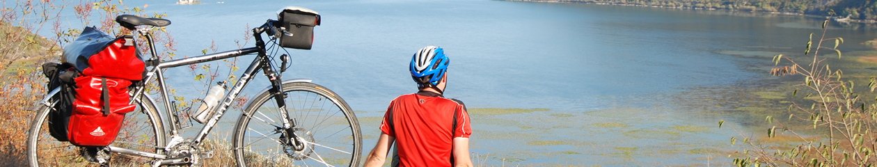
Rikavačko Lake (50 km, 1313 altitude)
We arrive at Rikavačko lake and we’re delighted to see the yellow boards with signposts and distances. We are a little less pleased with the fact that we are down to 1313 meters altitude, and it will be a fierce payback when we head towards Bukumirksko lake. It is approximately 4PM, but the sun had gone down because all around us are peaks over 2000 meters in height, so it is cold and a bit depressing. The silence is disturbed only by Sasa Matic singing that comes from Toyota next to a wooden cottage. Around it there are several quite happy and drunk weekenders, spinning pig on a spit, they jump and enjoy in total privacy of this summer pasture. The lake is really nice. However, not nearly as Crno or Biogradsko lake but definitely worth visiting and camping. However, because of our time lag, we move on faster than we had planned. We knew that we would have to return to almost the previous height. This climb, and then descend to the valley with the lake took all his strength, so that the steepest section of the route we had to push our bikes. The next 400 meters ascent extends into only 2-3 kilometers so that the breaks were more frequent. However, with climb to the top, the sun returns again, as a reward. As if the new day began. Given the time of our departure, feeling was exactly as this was a new morning. It seems again that the only way of transportation here is Russian indestructible machine. We are now in a flat and sunny katun Širokar (1765 altitude). After five hours, we again get a mobile network. And this Katun is also alive, at least in the summer months. Another pillar with signposts and a few hundred meters away another cold water spring. Psychologically our strength has returned, and with a solid speed we continue. Some mild descents, several serpentines, and again stone field, and finally we enter much milder areas. Below us, to the right there is a large number of houses , we can see asphalt, and our second goal, Bukumirsko lake is near. We step on asphalt and we admire the quiet and almost inaudible hiss from tires on this flat ground. A paved road leads to the lake, except for the last few hundred meters.
Bukumirsko Lake (60km, 1421 altitude)
Finally we prepare a real barbecue which was planned much earlier, but we had sandwiches, bananas and chocolate bars to push us forward so far. From the lake the next 10 kilometers we ride along a wavy terrain, with short climbs and descents, as well as a superb new asphalt. What Romanians told us is now confirmed – that we have chosen more difficult direction, but while I type this in a comfy computer chair, I say so be it, it is a sweeter direction! To our right there is the village Brskut, however, it can be approached only through the road that from Bioca leads to Bratonožiće and continues to Veruas, but looking at a map, it is the only one kilometer as the crow flies. We pass the Lower and Upper Stravce, Krzanje, where there is a water spring that we, even though we needed water, we did not notice because it was already nighttime. We connect to Kuci road, in Brezojevo village, and next 20 kilometers we speed towards Podgorica.
Podgorica / Zlatica (107 km, 60 altitude)
The expedition ends around 21:30, some 14 hours after departure. 22 kilometers of gravel road definitely exhausted us and slowed us down, and the total length of the tour was 107 kilometers. We took breaks whenever they got tired, we were not in a hurry, though, in some places we could not go even 500m without stopping for a break. In any case phenomenal experience, beautiful landscapes, wildlife in the true sense of the word, untouched nature, desert in some parts. If only someone would try this tour because of this report of mine, then these lines and images get their full meaning. Definitely worth trying. It is hard, but all this is forgotten after a few days, and a phenomenal experience remains in one’s memory.


love it.
Where can you find accommodation in the Kucka Krajina?